13 Must see spots along the Icefields Parkway
The Icefields Parkway is one of Canada’s great road trips, linking Lake Louise and Jasper through 145 miles of mountains, glaciers, turquoise lakes and waterfalls. Discover 13 of the unmissable places that make this one of Canada’s most memorable drives.

The Icefields Parkway isn’t just a road - It’s a journey.
You could drive between Lake Louise and Jasper in a few hours, but we wouldn’t recommend treating the Icefields Parkway simply as a route from A to B. If you want to explore it properly, either split the journey over two days or start very early and leave plenty of room for spontaneous stops.
Allow more time than you think you’ll need. Mountain weather can change quickly, and traffic sometimes comes to a standstill when a bear or moose appears beside the road. With little phone signal and few facilities along the way, it pays to fill up before setting off, take some food with you and keep your plans flexible.
Our tip: If you can, drive it twice! There and back. You’ll get a second chance at anything hidden by clouds the first time around, and the scenery can feel surprisingly different when you approach it from the opposite direction.
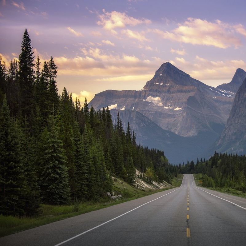
“I drove back and forth on the Icefields Parkway, and it was no punishment. The first day was foggy, and I couldn’t see much, but the weather was much clearer the next day, and I saw so many different things.”
— Sjanneke, Product Manager
What's the best way to drive the Icefields Parkway?
For us, a hire car gives you the best of both worlds. You still have the freedom to stop at lakes, waterfalls and viewpoints whenever you like, but at the end of the drive you can settle into one of the smaller lodges, cabins or B&Bs we’ve hand-picked around the Rockies.
It also means you’re not driving, parking and organising a larger vehicle every time you want to stop for a photograph or short walk. You keep the freedom of a road trip while still enjoying more personal places to stay and local recommendations along the way.

1. Lake Louise: off to a stunning start
Lake Louise is a natural starting point for the Icefields Parkway, but it’s worth giving yourself a couple of days to explore before heading north.
Moraine Lake Road is closed to personal vehicles year-round, while parking at Lake Louise is extremely limited during the busier months. Booking a shuttle or licensed transfer in advance is the most reliable way to visit both lakes without spending your morning looking for somewhere to park.

We’d recommend staying locally and giving this part of Banff National Park more than a quick photo stop. One of our hand-picked properties sits beside Moraine Lake, with mountain scenery, nearby walking trails and the chance to get out on the water by kayak.
It’s a peaceful base for exploring Lake Louise and the surrounding park before setting off early along the Icefields Parkway, when the roads are quieter and wildlife is often easier to spot.
Distance remaining: 145mi to Jasper

Bow Lake: a picture-perfect first stop
Around 24 miles from Lake Louise, Bow Lake sits almost beside the Icefields Parkway, making it an easy first stop.
Fed by meltwater from Bow Glacier, the lake has the vivid turquoise colour so closely associated with the Canadian Rockies. It is also the source of the Bow River, which flows south through Calgary before eventually reaching Hudson Bay.
Pull over, stretch your legs and take in the view, with plenty of time to stop for a photo or two. This is the sort of place that’s best enjoyed without watching the clock.

3. Peyto Lake: is this one of the Parkway’s best views?
Just 4 miles after Bow Lake, Peyto Lake is one of the best-known stops along the route and a favourite with our team too.
Named after Bill Peyto, an early trail guide and trapper in Banff, the lake is reached by a well-marked path from the car park. The return walk takes around 10 minutes, leading you to a viewpoint where the vivid turquoise water stretches out beneath the surrounding mountains.

Fed by glacial meltwater, Peyto Lake takes on its distinctive colour in summer when fine particles of rock flour are carried into the water. As the viewpoint comes into sight, it’s the sort of scene that deserves a moment before you reach for your camera.
This is one place where we’d forget about sticking to a strict timetable. Take the walk, enjoy the view and move on when you’re ready.
Side of the road: Left
Distance from the road: >0.5mi
Time to spend here: 40 minutes
Distance remaining: 116mi to Jasper
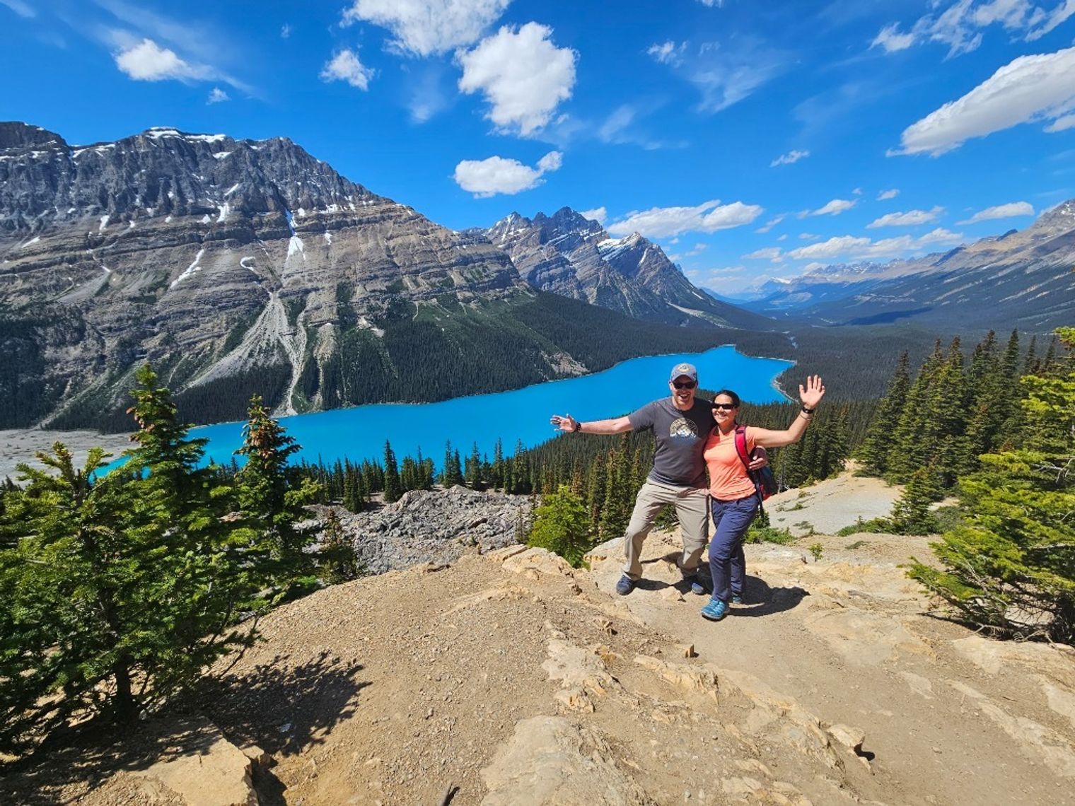
“I loved the walk up to Peyto Lake. It’s one of my favourite lakes in the Rockies.”
— Sjanneke, Product Manager
4. Waterfowl Lake: can you find a quiet moment?
A little further along, you’ll come to Waterfowl Lake, tucked just beside the road, making it an easy place to stop between the bigger sights.
Its glassy water often reflects the surrounding mountains, and there’s no major excursion required. Pull over, take in the scenery and enjoy one of the quieter moments of the drive.
These spontaneous stops are one of the reasons the Parkway works so well as a self-drive journey.
Distance travelled from last stop: 12mi
Side of the road: Left
Total distance travelled: 40mi

5. Saskatchewan River Crossing: restock and refuel
Around halfway along the Icefields Parkway, Saskatchewan River Crossing is the main place to stop for fuel, food and other essentials. As the only service point on the route, it’s worth making the most of it while you’re there.
The setting is just as memorable, where the North Saskatchewan, Howse and Mistaya rivers meet against a backdrop of mountain scenery.
Distance travelled from last stop: 11mi
Total distance travelled: 52mi
Distance remaining: 93mi to Jasper

Want to see the Rockies from above?
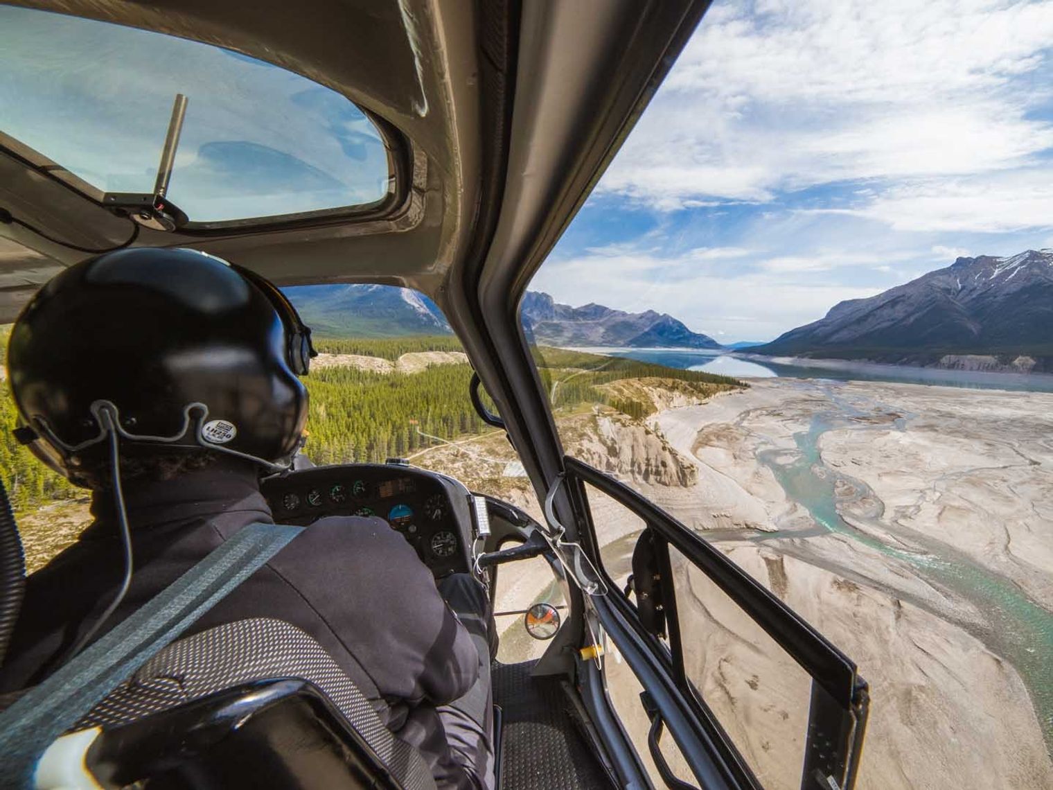
If your wider route takes you towards Nordegg, we can also arrange a helicopter flight over the Rockies.
From the air, you’ll take in the Columbia Icefield, the Continental Divide and some of the region’s highest peaks, with views of glaciers, deep crevasses and the vivid blue of the ice below. It’s a spectacular way to appreciate the scale of the landscape from a completely different perspective.
6. Weeping Wall: one of the easiest sights to spot from the road
The Weeping Wall tumbles down the cliffs beside the Parkway, with thin streams of water creating the impression that the mountain itself is crying. The largest cascade is fittingly named Teardrop.
In summer, water trickles down the rock face. In winter, the cliff can become a vast wall of ice, attracting experienced climbers.
You don’t even need to make a big detour. Sometimes the road itself provides the view.
Distance travelled from last stop: 17mi
Side of the road: Left
Time to spend here: 15 minutes
Total distance travelled: 68mi

7. Big Hill and Big Bend: admire on the way
Not every highlight requires getting out of the car.
You’ll know when you reach Big Hill and Big Bend. Here, the Icefields Parkway sweeps dramatically down the mountainside, opening up views across the valley, river and surrounding peaks.
Big Bend is the road’s famous hairpin turn, curving beneath towering mountains. There’s no need to stop; take it slowly and enjoy one of the most memorable stretches of the drive.
Distance travelled from last stop: 6mi
Total distance travelled: 74mi
Distance remaining: 71mi to Jasper

8. Parker Ridge: stop and stretch your legs
If you want to spend longer on foot, Parker Ridge is worth making time for.
The 3-mile return walk climbs to wide mountain views and a viewpoint over the Saskatchewan Glacier. It’s more demanding than the short roadside stops elsewhere on the Parkway, but it gives you the chance to properly step away from the car and into the landscape.
Take a picnic and make this one of the slower parts of your day.
Distance travelled from last spot: 2mi
Time to spend here: 180 minutes
Total distance travelled: 76mi

Do you need to stop everywhere?
Not at all.
There may be 13 places in this guide, but trying to tick off every one can quickly turn the Parkway into a race. We’d rather help you choose the walks and viewpoints that suit you, then leave enough room for the unplanned stops that usually become part of the story.
If your route brings you back along the Parkway later, you can always catch the places you missed the first time round.

9. Explore Athabasca Glacier
Part of the vast Columbia Icefield, Athabasca Glacier is one of the most striking sights along the Parkway.
You can see the glacier from the road and follow a short trail towards its edge, but never step onto the ice without an experienced guide.
For a closer look, our preference would be a guided ice walk. Travelling on foot gives you more time to understand the glacier itself and see how much the landscape has changed as the ice has retreated.

Our tip: Never venture onto the ice without an experienced guide. Guided tours are available for those who’d like to experience the glacier up close.
One option we offer is a guided glacier hike with a strong ecological focus. You’ll walk onto the Athabasca Glacier with a local guide, learning about the changing ice and seeing features such as crevasses, mill wells and drainage channels along the way. All specialist equipment is provided.
Distance travelled from last stop: 17mi
Time to spend here: 15 minutes
Total distance travelled: 68mi

10. Columbia Icefield Skywalk: are you brave enough to look down?
If you have a head for heights, the Columbia Icefield Skywalk gives you a very different perspective on the landscape.
The glass-floored walkway sits around 919 feet above the Sunwapta Valley, with mountain scenery stretching out around you. Access is by bus from the Columbia Icefield Discovery Centre, so this is one stop worth allowing a little extra room for in your day.
Distance travelled from last stop: 1mi
Side of the road: Left
Time to spend here: 60 minutes
Total distance travelled: 81mi

11. Sunwapta Falls: a thundering stop along the Icefields Parkway
At Sunwapta Falls, glacier-fed water drops around 59 feet through a narrow gorge. The falls are particularly powerful in late spring and early summer, when melting snow increases the river flow. The viewpoint is close to the car park, making this an easy stop as you continue towards Jasper.
Sometimes you’ll take a photograph and carry on. Other times, you’ll find it much harder to leave.
Distance travelled from last stop: 30mi
Side of the road: Left
Time to spend here: 15 minutes
Total distance travelled: 112mi
Distance remaining: 33mi to Jasper

12. Athabasca Falls: don’t be fooled by the height
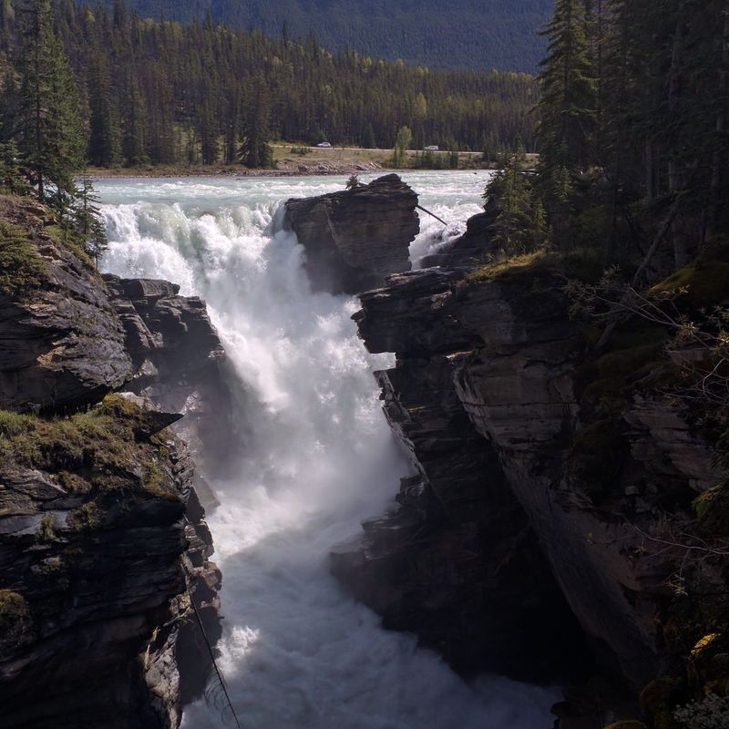
Athabasca Falls may not be the tallest, but the sheer power of the water makes it unforgettable. Over time, the river has carved striking shapes into the surrounding rock, creating a dramatic setting.
The falls are easy to reach from the car park, with a short trail and bridge leading to viewpoints on the far side. Visit in winter and the frozen cascades are every bit as mesmerising.
Distance travelled from last stop: 15mi
Side of the road: Left
Distance from the road: <1mi
Time to spend here: 30 minutes
Total distance travelled: 15m
13. Jasper: time to park up and stay awhile
Distance travelled from last stop: 18mi
Time travelled since last stop: 28
Total distance travelled: 145mi
Total time travelled: 10.7 hours
Reaching Jasper shouldn’t mean immediately packing up for the next spot.
Spend a few nights here and give yourself time to explore the national park as well as the town itself. After a full day on the Parkway, check into your accommodation, freshen up and enjoy a relaxed evening.
One local option our team enjoyed is a theatre show. For a lighter end to the day, enjoy a show about Jasper. It’s a fun, energetic introduction to the town, with plenty of humour and local insight, and you can arrive early for a drink with mountain views before the performance.

What’s the best way to include the Icefields Parkway in your Canada holiday?
For us, the Icefields Parkway works best as part of a slower self-drive journey through the Rockies.
A hire car gives you the freedom to stop when wildlife appears, change your plans with the weather and travel the route in both directions if the rest of your journey allows. Spring and autumn can be particularly rewarding for wildlife, so keeping your eyes on the roadside can be just as important as watching for the next viewpoint.
At either end, we can match your driving days with smaller, hand-picked places to stay and local experiences, while giving you enough nights in each area to properly enjoy where you’ve arrived.
Our specialists have driven these roads themselves, so they can help you decide which stops are worth your time, which walks suit you and how the Icefields Parkway fits naturally into the rest of your Canada journey.

Frequently asked questions
The Icefields Parkway can be driven in three to five hours (nonstop), but we usually recommend allowing a full day. The route covers around 145 miles between Lake Louise and Jasper, and the best experience comes from starting early, stopping often, and reaching Jasper in time for dinner.
Our favourite time is usually June to September, when daylight is long, most trails are more accessible, and the lakes show their vivid blue-green colour. May and October can be quieter but more weather-dependent, while winter driving requires extra care, preparation and regular road-condition checks.
Yes, the Icefields Parkway is absolutely worth visiting and is often one of the highlights of a Canadian Rockies road trip. It links Lake Louise and Jasper through glaciers, waterfalls, lakes and high mountain scenery, so it feels less like a transfer and more like a full day’s experience.